About

Ordesa and Monte Perdido National Park is located right in the middle along the border of Spain and France. It covers an area of 96 square miles (sq km 156) and is one of the protected areas for the Pyrenees. Pyrenees National Park is the protected area on the France side of the border. The national park was the first established in Spain and one of the earlier parks from around the world.

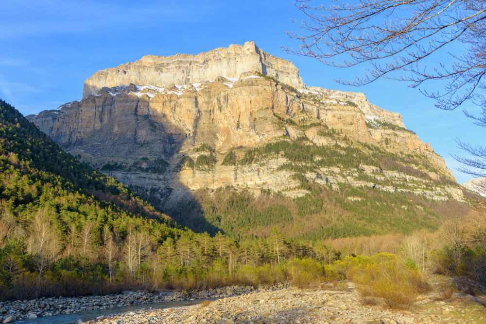
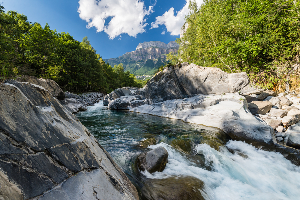
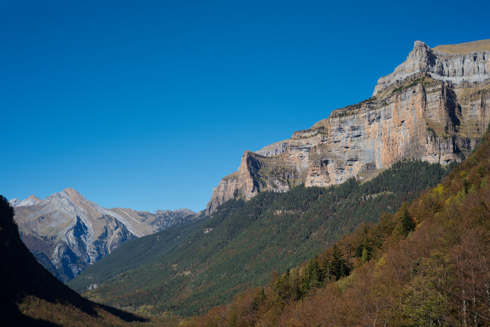
The Pyrenees is a mountain range that creates a natural border between Spain and its neighboring France. This mountain boundary also creates a natural separation and sets aside the Iberian Peninsula. Summits of the mountain range reach a height of 11,168 feet (3,404 m). Mount Perdido reaches a summit of 11,000 feet (3,355 m) and is the third tallest summit in the Pyrenees.

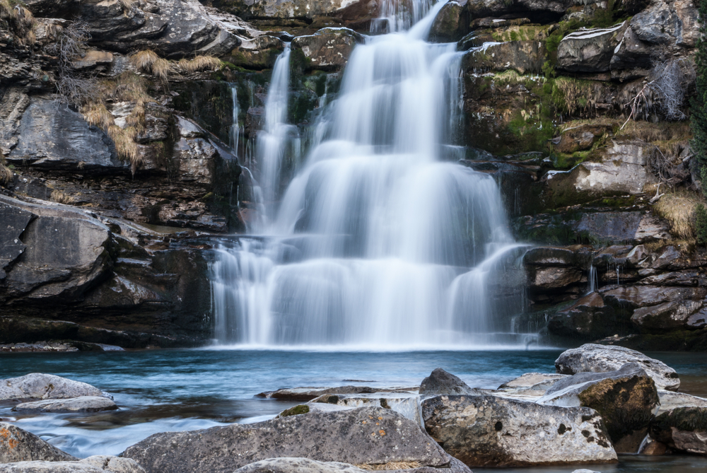
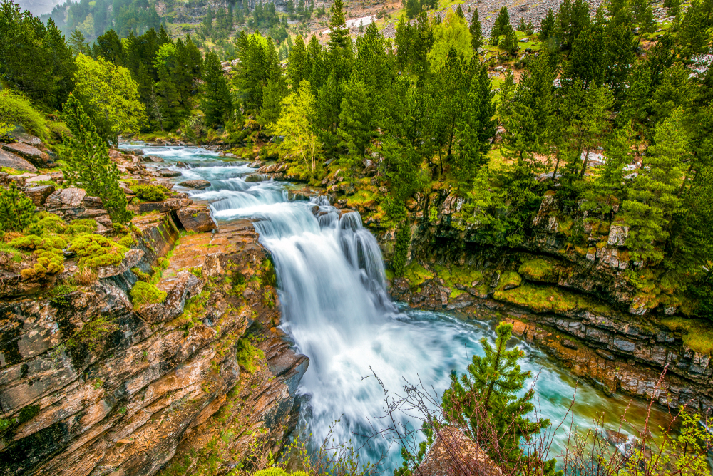
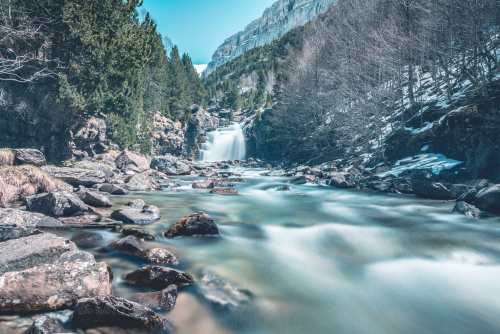
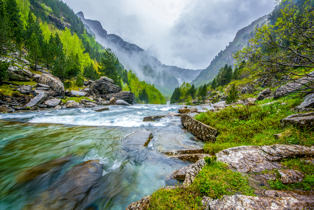
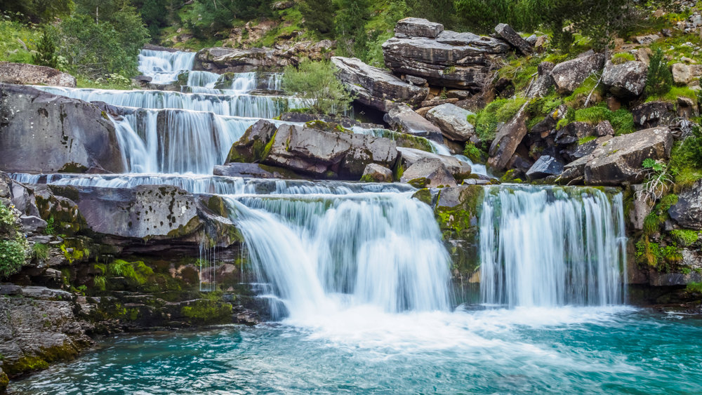
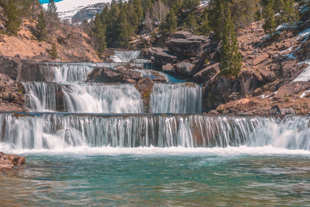
The Ordesa Valley is one of the most aesthetically pleasing areas of the park and is what part of the name is attributed. The Rio Arazas River traverses through this valley providing beautiful landscapes, views of multiple waterfalls, and opportunities to look up at the majestic massifs surrounding the river valley.

The vegetation of the park varies by altitudes. The lower elevations under 4,921 feet (1,500 m) feature forests comprised of silver fir, Scots pine, downy oak, silver birch, willows, and common ash. Mountain pine becomes the predominant forest at elevations above 6,561 feet (2,000 m).

The flowering plants that occur in the meadows at elevations between 5,577 and 9,942 feet (1,700 and 3,000 m) include bellflower, Pyrenean violet, long-leafed butterwort, and of course the edelweiss which is used as one of the symbols used for the park.

The mountain range features glacial lakes, river ravines, cascading waterfalls, and an abundance of flora and fauna to captivate the senses. It is both a UNESCO World Heritage site and a biosphere reserve.

Wildlife of Ordesa and Monte Perdido National Park include brown bear, boar, red squirrel, marmot, red fox, badger, groundhog, weasel, and the goat-antelope known as the chamois.  There are 32 different species of mammals.

The skies feature the Egyptian vulture, the bearded vulture, and the majestic golden eagle. The golden eagle is known to carry off prey larger than itself; it is a magnificent predator. There are 171 species of birds with the golden eagle serving as the pinnacle sighting. It would be even more exciting if you witnessed a golden eagle successfully capturing and carrying off its prey.

Things to See

Ordesa and Monte Perdido National Park is a pristine region of the Pyrenees, protected by Spain because of both beauty and natural resources. The best way to experience this amazing wonder of nature is by hiking and trekking through the forests and valleys.

Mount Perdido

Mount Perdido is part of the Monte Perdido Range in the western Pyrenees. The summit reaches a peak at 11,000 feet (3,355 m).  It is a daunting view from the Ordesa Valley down below.  Although located in France, the mountain may be accessed easier from the Spain side of the Pyrenees.  The name means “lost mountain” and was ascribed to the mountain because it was not visible from the French side.

Ordesa Valley

The Ordesa Valley stretches across 7 miles (11 km) in length.  The valley runs east to west.  The valley is renowned for views of waterfalls that make their way out of the Pyrenees and into the valley below.  Ordesa Valley provides impressive views of Mount Perdido.  The valley is home to many of the abundant wildlife species found in the park.

Ordesa y Monte Perdido National Park Trails

The more adventurous can embark on the full day trail along the river gorge. This provides the trekker with views of several waterfalls. The park is filled with varying hiking trails that differ in both length and difficulty making it easy for everyone to explore some aspect of the park.

One of the trail options that should be explored follows along the Ordesa Valley followed by another trail to see the amazing Horsetail falls, locally known as Cola de Caballo.

placeholder

Senda de los Cazadores Trail

This trail is rated moderate and crosses a distance of 11.4 miles (18.35 km).  During the blooming season, the trail provides great views of wildflowers.

placeholder

Canon de Anisclo Trail

This is a 3.4-mile (5.47 km) trail out and back that meanders along a river and provides great views of riverine landscapes.  The trail takes about 2 hours and is rated moderate.

placeholder

Faja Racon y Faja de las Flores

This is a challenging trail that travels 9.5 miles (15.2 km) atop cliffs that overlook the valley below.  It is rated difficult and not for those with fears of heights.

placeholder

Ordesa Valley Trail

Rating: Moderate

Distance and Elevation Gain: 8 miles (13 km) round trip, with an elevation gain of about 1,640 feet (500 meters)

Description: This trail takes hikers through the heart of the Ordesa Valley, offering stunning views of waterfalls, towering cliffs, and lush forests.

It’s accessible to most hikers and leads to the iconic Cola de Caballo waterfall.

placeholder

Faja de las Flores

Rating: Challenging

Distance and Elevation Gain: 16 miles (26 km) round trip, with an elevation gain of about 3,280 feet (1,000 meters)

Description: One for experienced hikers, this trail skirts high above the Ordesa Canyon, offering breathtaking panoramic views.

The narrow path, with steep drop-offs, requires a head for heights and good fitness level.

placeholder

Goriz Hut to Monte Perdido

Rating: Very Challenging

Distance and Elevation Gain: 5 miles (8 km) round trip, with an elevation gain of about 3,937 feet (1,200 meters)

Description: Starting from the Goriz Hut, this trail ascends to the summit of Monte Perdido.

It’s a tough climb involving steep, rocky terrain and snow fields, but it rewards hikers with spectacular views of the surrounding Pyrenees.

placeholder

Circo de Soaso via Añisclo Canyon

Rating: Moderate to Challenging

Distance and Elevation Gain: 12 miles (19 km) round trip, with an elevation gain of about 2,296 feet (700 meters)

Description: This trail takes hikers through the Añisclo Canyon to the breathtaking Circo de Soaso, a natural amphitheater surrounded by high cliffs.

It features diverse landscapes, including forests, meadows, and streams.

placeholder

Brecha de Rolando

Rating: Challenging

Distance and Elevation Gain: 10 miles (16 km) round trip, with an elevation gain of about 3,280 feet (1,000 meters)

Description: The trail to the iconic Brecha de Rolando, a natural gap in the mountains bordering France and Spain, is a challenging hike that offers some of the best views in the park.

It’s a steep ascent to a dramatic, narrow pass with stunning vistas of the surrounding peaks.

placeholder

Ordesa Valley Trail

Rating: Moderate

Distance and Elevation Gain: 8 miles (13 km) round trip, with an elevation gain of about 1,640 feet (500 meters)

Description: This trail takes hikers through the heart of the Ordesa Valley, offering stunning views of waterfalls, towering cliffs, and lush forests.

It’s accessible to most hikers and leads to the iconic Cola de Caballo waterfall.

placeholder

Faja de las Flores

Rating: Challenging

Distance and Elevation Gain: 16 miles (26 km) round trip, with an elevation gain of about 3,280 feet (1,000 meters)

Description: One for experienced hikers, this trail skirts high above the Ordesa Canyon, offering breathtaking panoramic views.

The narrow path, with steep drop-offs, requires a head for heights and good fitness level.

placeholder

Goriz Hut to Monte Perdido

Rating: Very Challenging

Distance and Elevation Gain: 5 miles (8 km) round trip, with an elevation gain of about 3,937 feet (1,200 meters)

Description: Starting from the Goriz Hut, this trail ascends to the summit of Monte Perdido.

It’s a tough climb involving steep, rocky terrain and snow fields, but it rewards hikers with spectacular views of the surrounding Pyrenees.

placeholder

Circo de Soaso via Añisclo Canyon

Rating: Moderate to Challenging

Distance and Elevation Gain: 12 miles (19 km) round trip, with an elevation gain of about 2,296 feet (700 meters)

Description: This trail takes hikers through the Añisclo Canyon to the breathtaking Circo de Soaso, a natural amphitheater surrounded by high cliffs.

It features diverse landscapes, including forests, meadows, and streams.

placeholder

Brecha de Rolando

Rating: Challenging

Distance and Elevation Gain: 10 miles (16 km) round trip, with an elevation gain of about 3,280 feet (1,000 meters)

Description: The trail to the iconic Brecha de Rolando, a natural gap in the mountains bordering France and Spain, is a challenging hike that offers some of the best views in the park.

It’s a steep ascent to a dramatic, narrow pass with stunning vistas of the surrounding peaks.

Sources