
About
Peak District National Park, the park is located in central and northern England between the major cities of Manchester and Sheffield. Covering approximately 555 square miles (1,438 sq km), it was the first national park established in the United Kingdom.
Designated in 1951, the park protects a diverse landscape of rolling hills, limestone valleys, moorlands, reservoirs, caves, and traditional English countryside. Situated at the southern end of the Pennine Mountains, the Peak District is one of Britain’s most accessible protected areas, attracting millions of visitors each year. Despite its proximity to major urban centers, the park preserves a rich natural and cultural heritage that has become an enduring symbol of outdoor recreation and conservation in England.
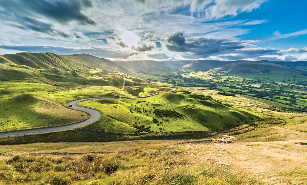
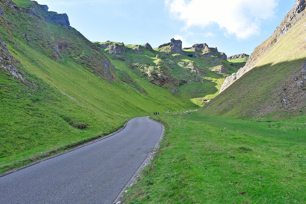
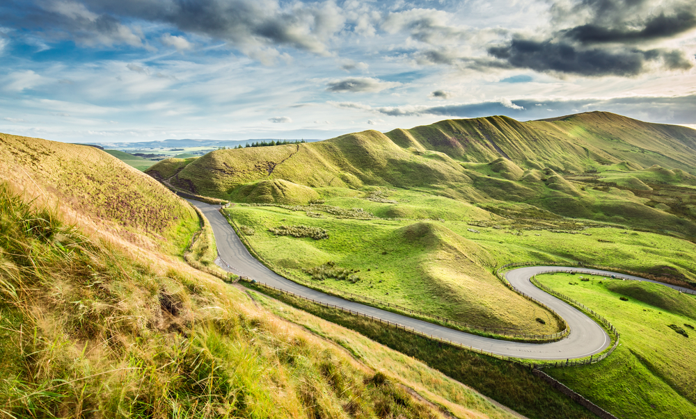
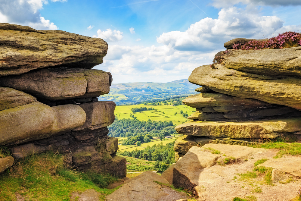
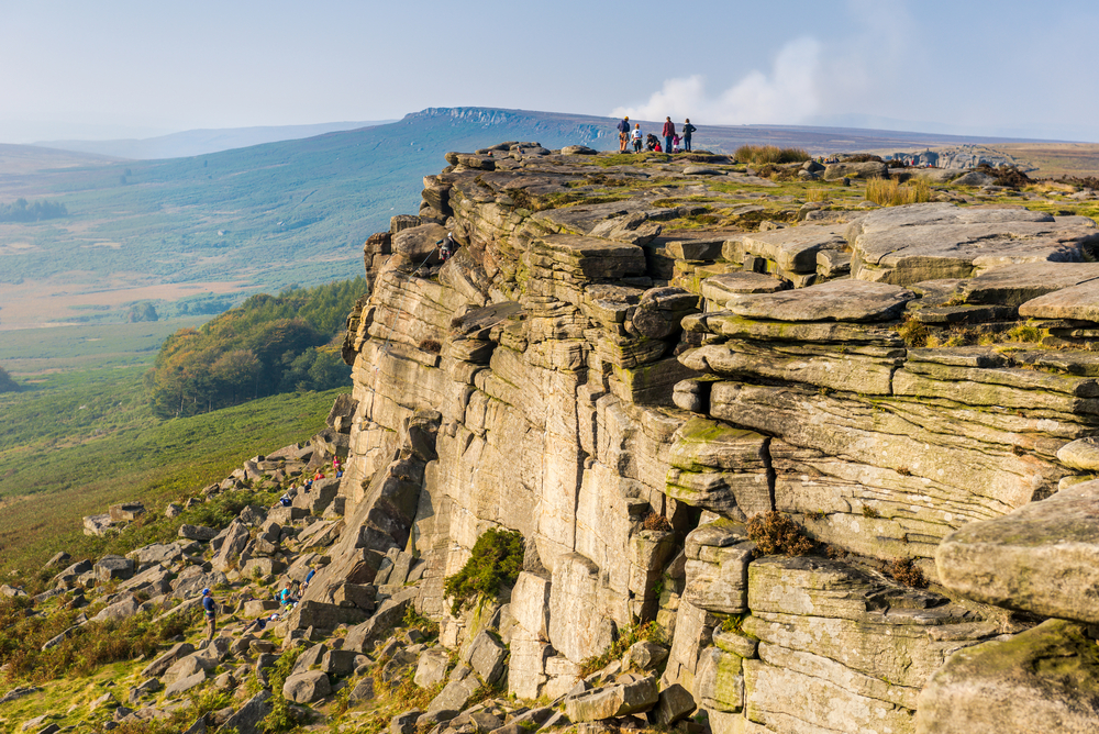
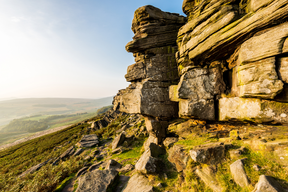
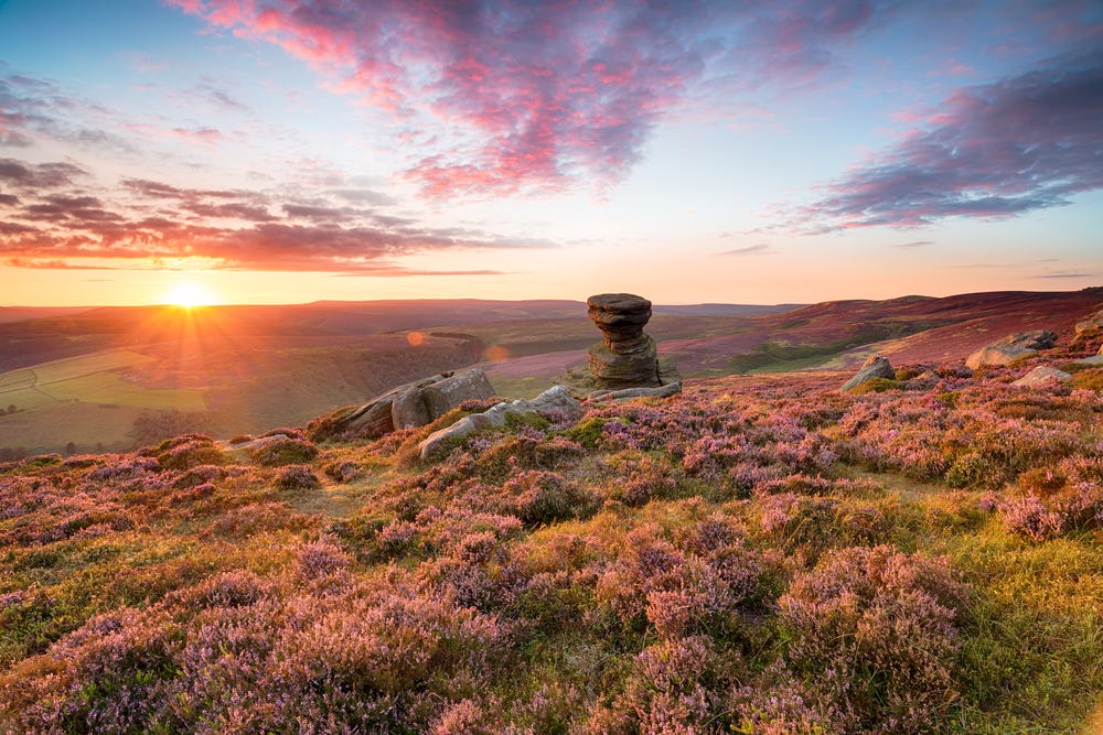
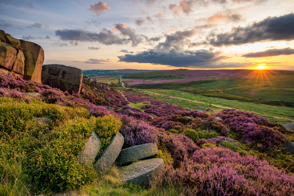
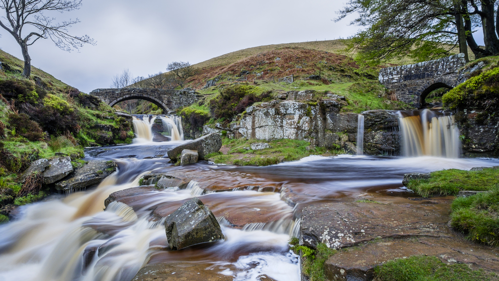
Peak District National Park is best known for its contrasting landscapes of the Dark Peak and White Peak regions. The Dark Peak, located primarily in the north, features rugged gritstone moorlands, dramatic escarpments, and expansive upland scenery. The White Peak, found mainly in the south, is characterized by rolling limestone hills, picturesque dales, and charming villages built from local stone.
Visitors are drawn to the park’s extensive network of walking trails, cycling routes, climbing areas, and scenic viewpoints. Popular destinations include Mam Tor, Kinder Scout, Dovedale, and Stanage Edge, all of which showcase the remarkable variety of landscapes found within the park. The Peak District is widely regarded as one of Britain’s premier outdoor recreation destinations.
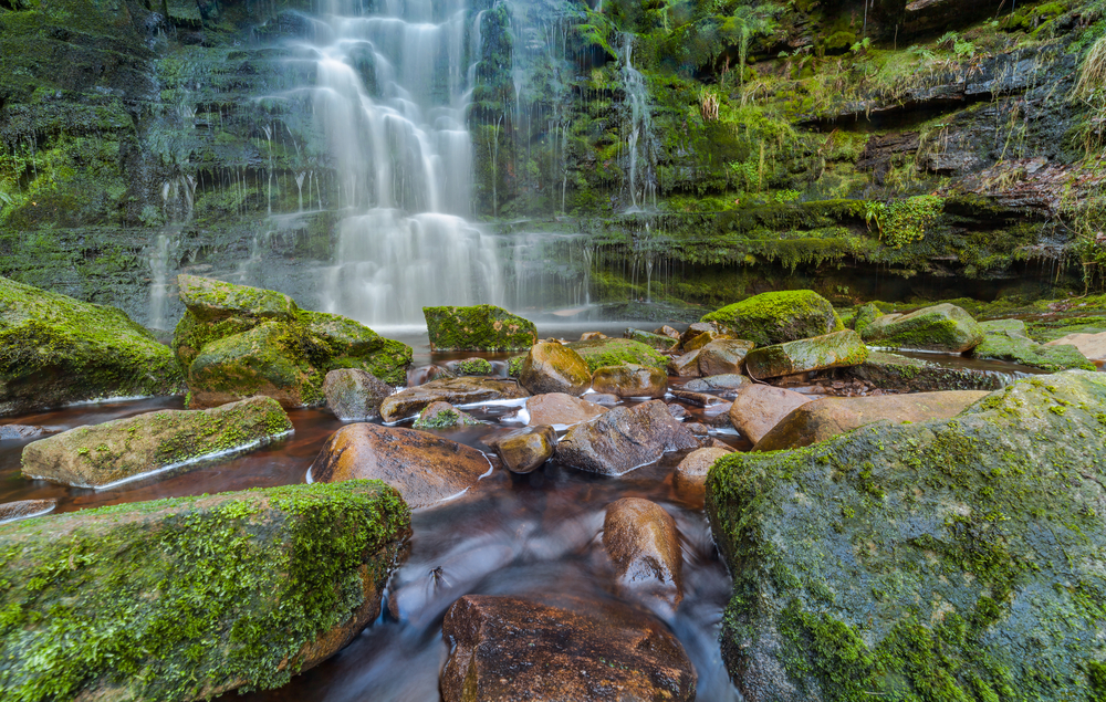
The geography of Peak District National Park reflects millions of years of geological history. Limestone formations dominate the White Peak and have created caves, gorges, sinkholes, and underground river systems. In contrast, the Dark Peak is composed largely of gritstone and shale, resulting in broad moorlands, peat bogs, and striking rock outcrops.
Kinder Scout, the park’s highest point at approximately 2,087 feet (636 meters), rises above the surrounding landscape and forms part of the Pennine watershed. Rivers including the Derwent, Dove, Wye, and Manifold flow through the park’s valleys and contribute to its ecological diversity. This varied terrain supports an impressive range of habitats and species.
Wildlife within Peak District National Park reflects the diversity of its upland and lowland environments. Mammals include red deer, roe deer, foxes, badgers, hares, and several bat species that inhabit the park’s caves and woodlands. Birdlife is particularly important, with species such as curlews, lapwings, peregrine falcons, merlins, short-eared owls, and red grouse found throughout the moorlands and valleys.
Rivers and wetlands support fish, amphibians, and aquatic invertebrates, while limestone grasslands contain a rich variety of wildflowers, butterflies, and pollinating insects. The park’s habitats are among the most ecologically significant in England and support numerous species of conservation concern.
Peak District National Park plays a vital role in conserving England’s upland ecosystems, cultural landscapes, and outdoor heritage. The park protects important watersheds, peatlands, limestone habitats, archaeological sites, and centuries-old farming traditions. It also occupies a special place in British conservation history, as the creation of the park helped establish public access and national park protections throughout the United Kingdom.
Its conservation significance is often compared to Yorkshire Dales National Park and Lake District National Park because of its ecological value, scenic beauty, and recreational importance. Today, Peak District National Park remains one of Britain’s most treasured landscapes, preserving a remarkable environment where nature, history, and outdoor adventure continue to thrive.
Photos
Things to See
Peak District National Park Trails
One of the primary activities of the national park is hiking throughout the wilderness and between the towns and villages. There are over 1,800 miles (2,900 km) of trails that traverse through, around, and over the varying landscapes of the park.

Park Protection
The primary purpose of the park is to protect the rolling hills and diverse landscapes from further development of inhabitants. The largest struggle comes from trying to balance the desires of the residents living in the area, the wishes of the travelers and visitors, and the efforts to protect the area. It is a constant juggling act.
The park is committed to protecting the wilderness that surrounds the various towns and villages while trying to maintain an additional commitment by providing ways for visitors to experience the natural outdoors and exquisite nature of the moorland and upland areas.
Sources
- All Trails, Best Trails in Peak District National Park, https://www.alltrails.com/parks/england/staffordshire/peak-district-national-park/river, retrieved July 2020.
- Britannica, Peak District, https://www.britannica.com/place/Peak-District-National-Park, retrieved July 2020.
- Culture Trip, 12 Reasons Why You Should Explore Peak District, https://theculturetrip.com/europe/united-kingdom/england/articles/12-reasons-why-you-should-explore-englands-peak-district/, retrieved July 2020.
- Peak District, Welcome to Peak District, https://www.peakdistrict.org/, retrieved July 2020.
- Peak District National Park, government site, https://www.peakdistrict.gov.uk/home, retrieved July 2020.
- Visit Buxton, Peak District, https://www.visitbuxton.co.uk/peak-district-national-park/, retrieved July 2020.
- Visit Peak District, Peak District and Derbyshire, https://www.visitpeakdistrict.com/, retrieved July 2020.