About

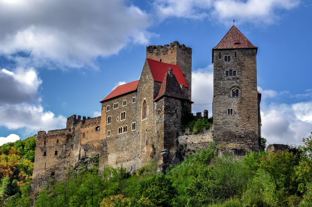
Thayatal National Park is located on the eastern side of Austria along the northern border shared with the Czech Republic.  The park covers an area of 5.02 square miles (13 sq km) making it the smallest of Austria’s national parks.

This protected area is also known as the Thaya Valley National Park, and then sometimes it is combined with the neighboring Podyji National Park in the Czech Republic and referred to as the Thayatal-Podyji National Park.

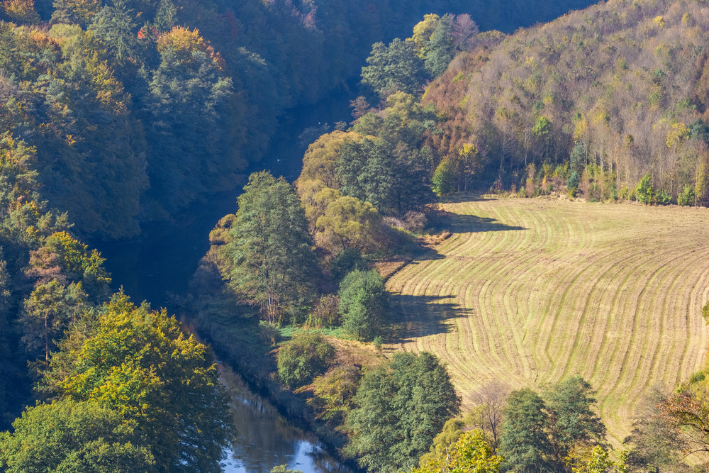
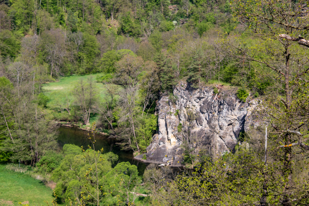
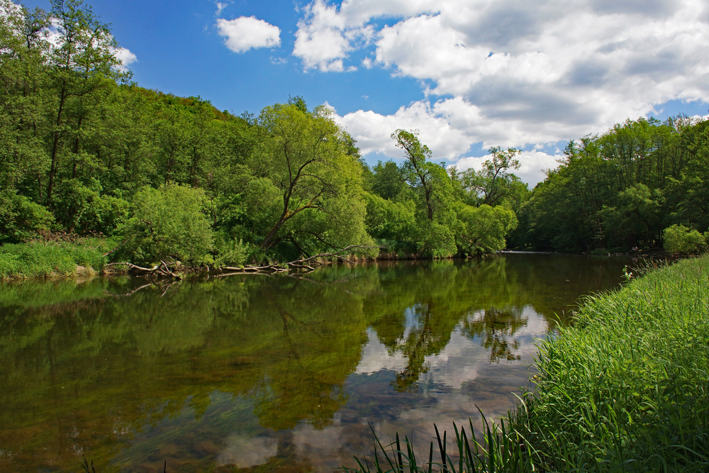
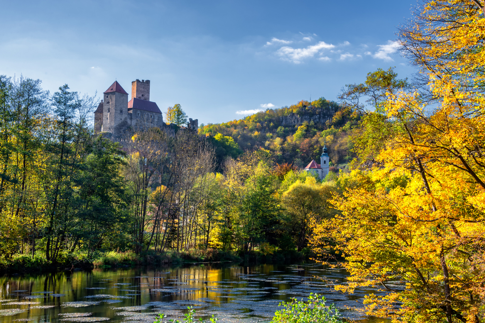
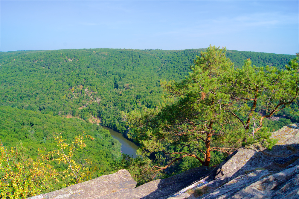
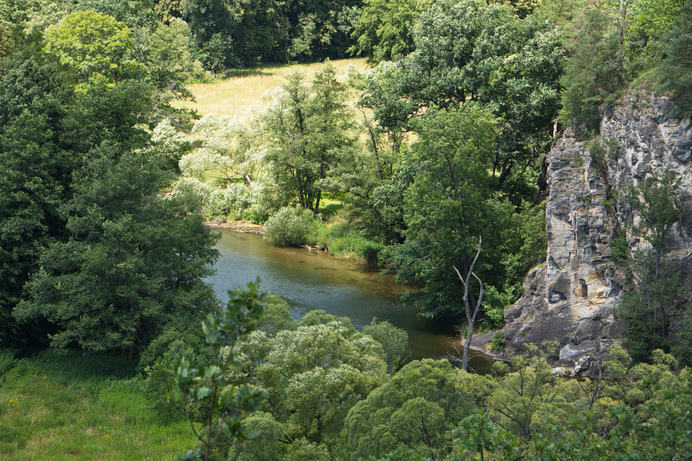
The heart of the national park lies in the Thaya Valley where the Thaya River features gneiss slopes alongside the riverbanks. In some cases, the slopes are quite steep, and even near-vertical rock faces.

The vegetation includes forested banks along with variegated iris, yellow lady’s slipper, Turk’s-cap lily, and the Cornelian cherry.  All but about 10% of the park is blanketed with forests comprised of conifers, red pines, fir, and junipers.  Some of the vegetation is endangered increasing the value of the protected area.

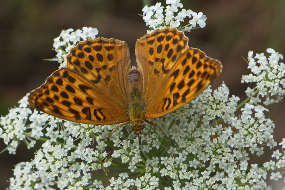
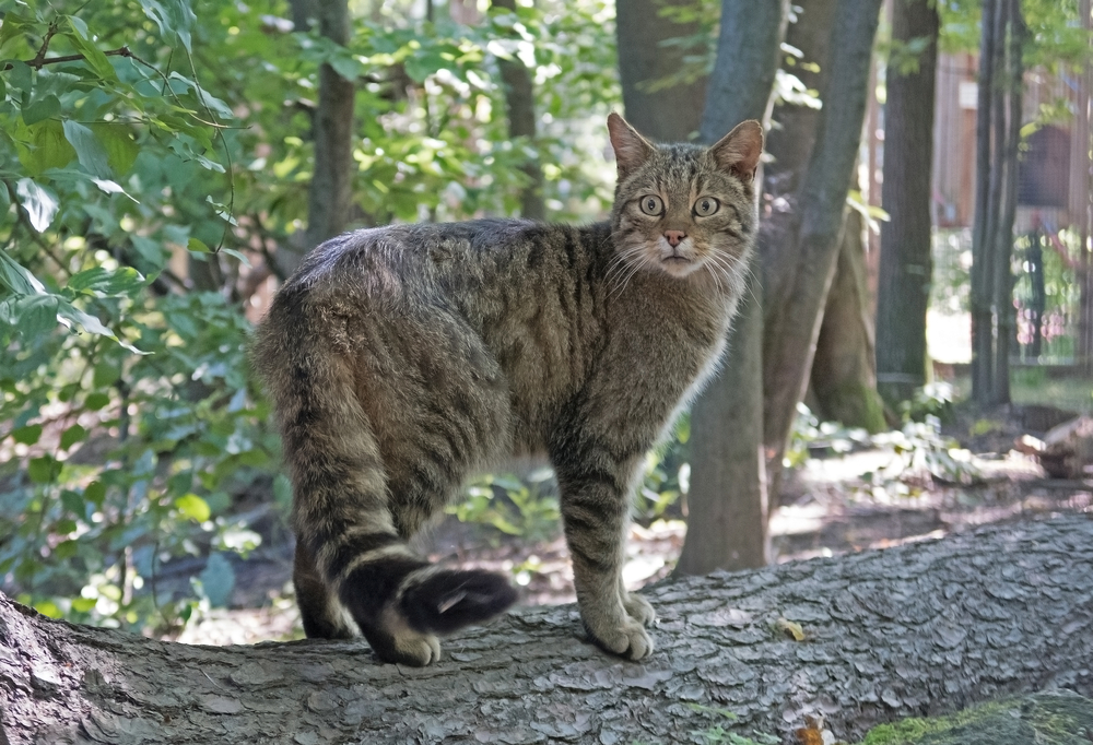
The ecosystem is not known for its wildlife.  The wild cat is shy and elusive; however, it is one of the coveted animal sightings. The black stork is one of the more popular bird species that may be seen.  The European otter is a fun sighting playing in or along the river.

Things to See

The national park is the smallest protected area in Austria and subsequently leaves little room for many highlights.  The focal point of the national park is the Thaya River running through the Thaya Valley.

Thaya River

The Thaya River stretches well outside the borders of the national park covering a distance of 139 miles (224 km).  There are two river sources combining to create the larger Thaya River.  The German Thaya and the Moravian Thaya.  This extends the length of the river to 200 miles (322 km).

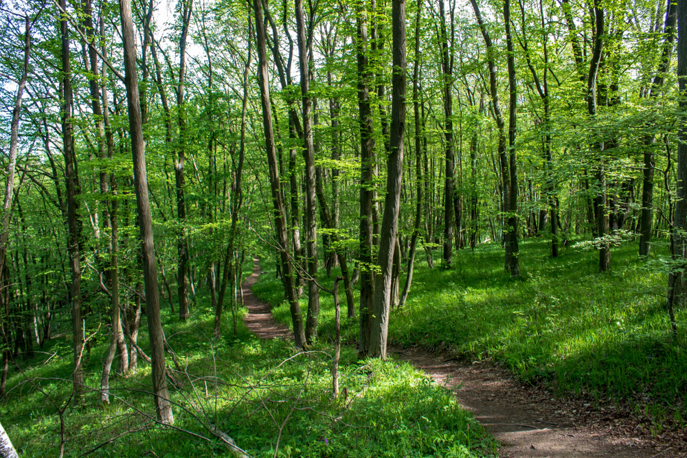
Thayatal National Park Trails

Thayatal features a series of hiking trails for exploring its diversity while also providing access to the cross-border hiking trails that allow you to also visit Podyji National Park in the Czech Republic.

placeholder

Merkersdorf – Umlaufberg Trail

This is a loop trail that covers 6.3 miles ( km) with an elevation gain of 1,020 feet ( m).  The trail meanders through the forest and along the Thaya River.  There are chances to see wildflowers and wildlife, however, the panoramic views are the highlight of the outing.

placeholder

Thayatal-Radweg Trail

This is a medium-rated extensive hike.  The trek up the mountain and along the Thayatal River features an accumulative elevation gain of 5,721 feet (1,744 m) while covering a distance of 78 miles (125.55 km).  The panoramic views out over the river and forests are astounding.  You will also pass by castles and palaces reflecting the cultural heritage of the area.

placeholder

Hennerweg Trail

This is a trail through the forest with a scenic lookout over the town.  The trail only takes 30 minutes with an elevation gain of only 91.9 feet (28 m).  The easy excursion covers a distance of 1.17 miles (1.89 km).

placeholder

Einsiedlerweg – Wildkatzenwanderweg Trail

This is another rated-easy trail that features a little more elevation gain at 738.2 feet (225 m) while traversing along the river and through the forest over a distance of 3.73 miles (6 km).  It provides amazing views over the forest and river with glimpses back towards the town.

Thayatal National Park

Hardegg Castle Loop Trail

Rating: Easy

Distance and Elevation Gain: 3 miles (5 km) with minimal elevation gain

Description: The Hardegg Castle Loop Trail takes hikers on a scenic journey through the picturesque landscapes surrounding Hardegg Castle.

Wander through ancient forests, along the tranquil banks of the Thaya River, and past charming villages. Marvel at the medieval architecture of Hardegg Castle and enjoy panoramic views of the surrounding countryside.

This leisurely hike offers a perfect blend of history, nature, and cultural exploration.

Thayatal National Park

Devil's Canyon Trail

Rating: Moderate

Distance and Elevation Gain: 5 miles (8 km) with an elevation gain of 656 feet (200 meters)

Description: The Devil’s Canyon Trail winds through the dramatic rock formations and lush forests of Thayatal National Park.

Hikers will navigate narrow paths along the edge of the canyon, offering breathtaking views of the rugged landscape below.

Keep an eye out for rare plant species clinging to the cliffs and listen for the calls of birds echoing through the canyon. This moderately challenging hike promises adventure and stunning natural beauty.

placeholder

Ruins of Kaja Castle Trail

Rating: Easy to Moderate

Distance and Elevation Gain: 4 miles (6.5 km) with an elevation gain of 328 feet (100 meters)

Description: The Ruins of Kaja Castle Trail leads hikers on a journey through time, exploring the ancient ruins of Kaja Castle and the surrounding countryside.

Wander through shady forests, across rolling meadows, and along the banks of the Thaya River. Discover the rich history of the castle and enjoy panoramic views of the picturesque Thayatal Valley.

This scenic hike is suitable for all skill levels and offers a glimpse into the region’s past.

placeholder

Altenburg Ruins Trail

Rating: Moderate

Distance and Elevation Gain: 6 miles (10 km) with an elevation gain of 984 feet (300 meters)

Description: The Altenburg Ruins Trail takes hikers on a captivating journey through the rugged landscapes of Thayatal National Park to the historic ruins of Altenburg Castle.

Trek through dense forests, climb rocky hillsides, and explore ancient ruins perched high above the Thaya River.

Enjoy panoramic views of the surrounding countryside and immerse yourself in the rich history and natural beauty of this enchanting region.

placeholder

Thaya River Loop Trail

Rating: Easy

Distance and Elevation Gain: 2.5 miles (4 km) with minimal elevation gain

Description: The Thaya River Loop Trail offers a leisurely stroll along the banks of the picturesque Thaya River, surrounded by lush forests and tranquil meadows.

Listen to the soothing sound of flowing water and watch for wildlife along the riverbanks. Discover hidden waterfalls, ancient rock formations, and charming riverside villages as you explore this idyllic landscape.

Perfect for families and casual hikers, this trail provides a peaceful escape into nature.

Park Protection

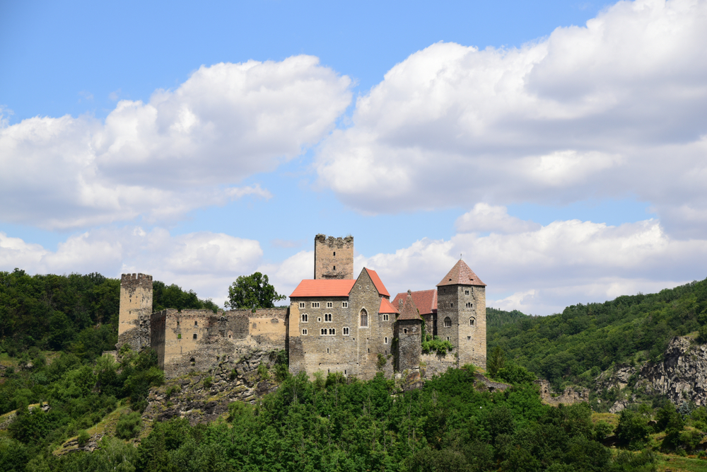
Thayatal National Park was created to protect the Thaya River and Thaya Valley which features the unique gneiss rock formations and slope of the riverbank.  It is an incredibly picturesque part of the river which is jointly protected on the Czech Republic side of the border.


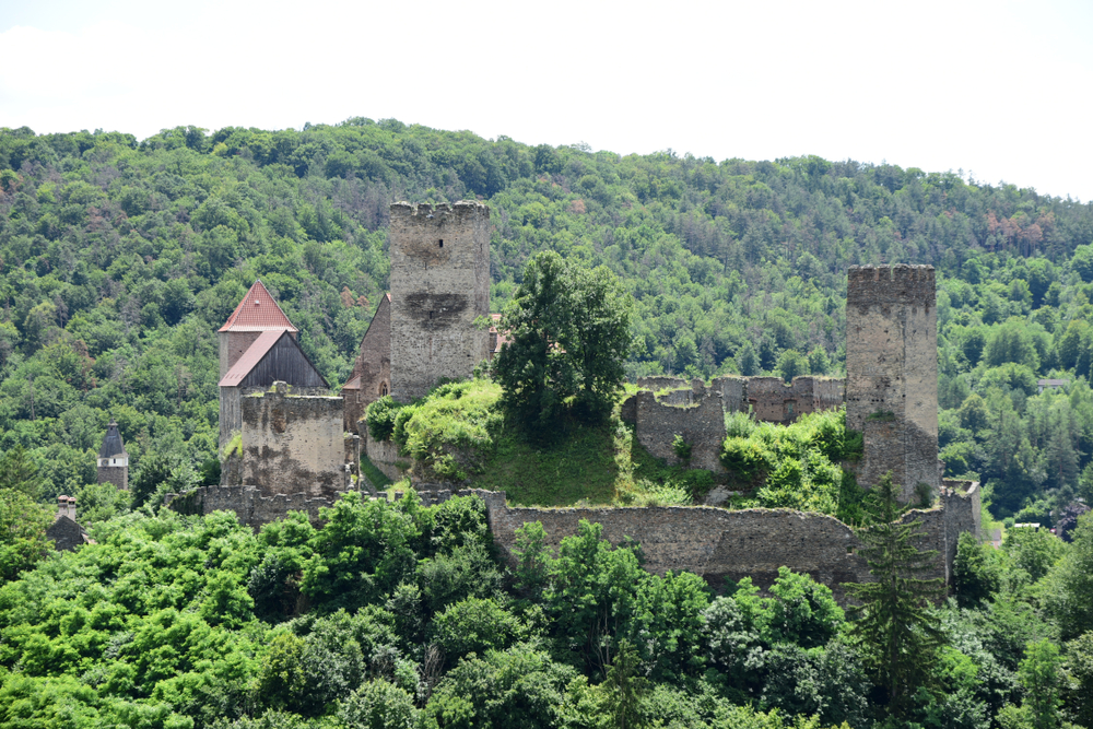
Although the park is small and not known for wildlife, it is home to a number of endangered species in both the flora and fauna categories.  The national park reflects the country’s commitment to protecting these endangered species while also providing protection on the scenic landscapes and cultural heritage found in the area.

Sources