About

Kalkalpen National Park is located in the northern limestone Alps of the north-central part of Austria.  The national park encompasses an area of 80.4 square miles (208.23 sq km).

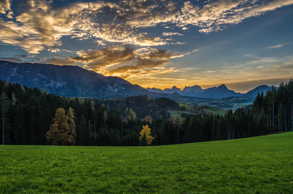
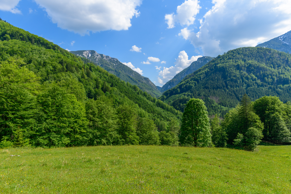
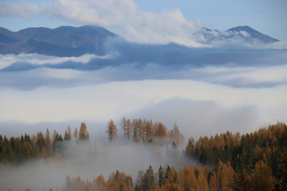
Kalkalpen offers a variety of picturesque landscapes with forests accounting for the largest (81%) of the park’s area.  This beech forest is a significant representation of beech forests of the Alps and this triggered the UNESCO World Heritage recognition.  It is central Europe’s largest forested area.

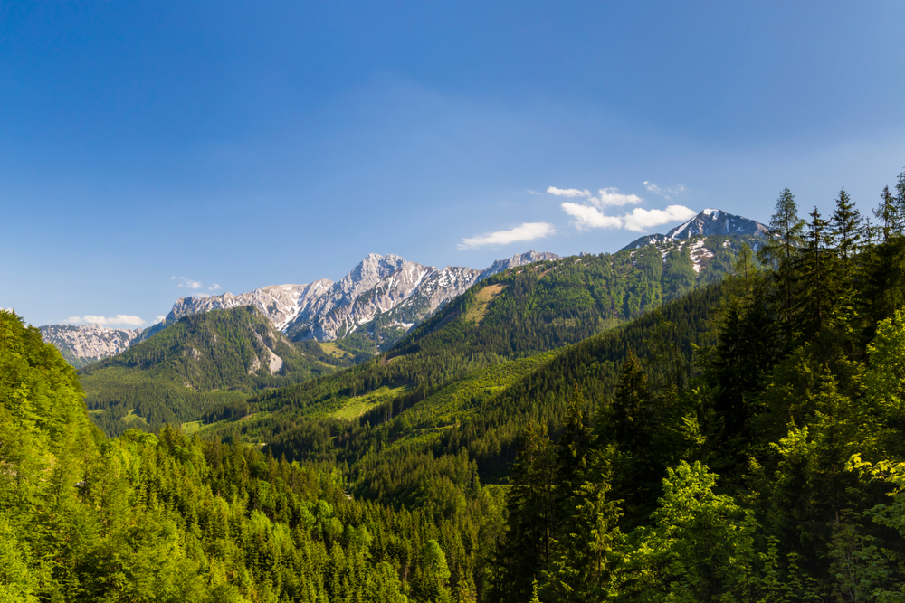
The park features two mountain ranges which include Sengsengebirge and Reichraminger Hintergebirege.  There are gorges tucked into the mountain ranges and home to some of the many rivers.

The elevation of the park ranges from 1,263.12 feet (385 m) to 6,440.28 feet (1,963 m) above sea level.  There are 124.27 miles  (200 km) of stream beds that meander throughout the park.  The park’s covering of forests, combined with the abundant number of rivers and streams, makes this is a haven for wildlife.

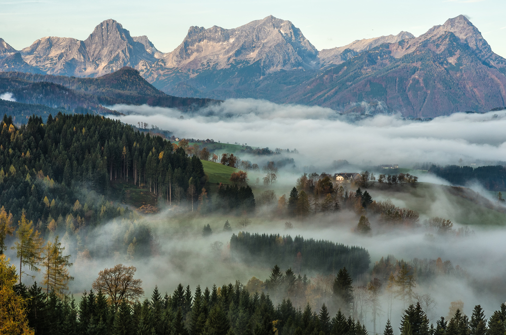
Wurbauerkogel is 69 feet (21 m) high lookout tower that provides panoramic views of the region.  It can be accessed by chair lift or different trails that reach the tower.  It provides views of 21 different peaks that reach heights over 6,600 feet (2,000 m).

Here is the breakdown of the makeup of the rest of the park:

  • Mountain pine 8%
  • Alpine meadows 6%
  • Rock and scree 5%

The wildlife of the park is diverse with 50 species of mammals and 80 species of birds.  There are around 1,000 species of flowering plants with 42 of them being wild orchids.

Things to See

The summer months are the best time to explore the wilderness the park affords to travelers.  The winter months give way to winter activities including skiing and snowshoe hiking.

Kalkalpen National Park Trails

There are multiple trails that help visitors experience the wilderness of the national park.  Almost all trails experience some type of elevation change.  The trails range from easy to difficult with most being moderate.

Hiking to the Wurbauerkogel lookout tower and ascending it to the top is a breathtaking highlight with stunning panoramic views that will leave you speechless.

placeholder

Gasthaus Polsterluckn – Schiederweiher

This is an easy 3.24-mile loop trail with only a 225-foot elevation change.  It takes about an hour and a half to complete.

placeholder

Dr. Vogelsang-Klamm-Hofalm Trail

This is a difficult 9.76-mile loop trail that takes about 6 hours to complete.  It features a 2,725-foot elevation change.

placeholder

Dumlerhutte-Gleinkersee Trail

This is an intermediate 4-5 mile loop trail that has an elevation change of 2,175 feet.

placeholder

Ausblick – Schiederweiher

This is a moderate 7.5-mile loop trail that features a 1,050-foot elevation change.  It takes about 3.5 hours to complete.

placeholder

Dr. Vogelsang-Klamm Trail

This is a moderate 6.21-mile loop hike with an elevation change of 2,275 feet.  This takes about 4.25 hours to complete.

placeholder

Stoderer Dolomitensteig

This is a 5.8-mile loop of moderate difficulty that travels up 2,275 feet before coming back down.  It takes about 4.5 hours to make the loop.

placeholder

Grimmingblick Trail

Rating: Moderate

Distance and Elevation Gain: 10 km with an elevation gain of 500 meters

Description: This trail offers breathtaking panoramic views of the Grimming Mountain.

Hikers will traverse through dense forests, cross crystal-clear streams, and ascend to scenic viewpoints.

The trail provides opportunities for wildlife spotting, including deer and various bird species. It’s a moderately challenging hike suitable for adventurous individuals seeking stunning vistas.

placeholder

Ötschergräben Trail

Rating: Difficult

Distance and Elevation Gain: 12 km with an elevation gain of 600 meters

Description: Known as the “Grand Canyon of Austria,” this trail winds through dramatic gorges, cascading waterfalls, and lush forests.

Hikers will navigate rugged terrain, including steep ascents and narrow pathways. The trail offers glimpses of rare flora and fauna thriving in the diverse microclimates of the Ötschergräben area.

It’s a challenging yet rewarding adventure for experienced hikers.

placeholder

Dürrenstein Trail

Rating: Moderate

Distance and Elevation Gain: 15 km with an elevation gain of 700 meters

Description: This trail leads hikers through the ancient forests of Dürrenstein, offering serene landscapes and tranquil surroundings.

Along the way, hikers will encounter picturesque alpine meadows, pristine mountain lakes, and towering peaks. The trail provides opportunities for wildlife observation, with chances to spot elusive creatures like chamois and marmots.

It’s a moderate hike suitable for nature enthusiasts seeking solitude and natural beauty.

placeholder

Gosau Lakes Trail

Rating: Easy to Moderate

Distance and Elevation Gian: 8 km with an elevation gain of 300 meters

Description: This scenic trail winds around the picturesque Gosau Lakes, offering stunning views of the Dachstein Massif reflected in the tranquil waters.

Hikers will stroll through lush meadows adorned with wildflowers and shaded forests alive with bird songs.

The trail provides access to pristine swimming spots and opportunities for leisurely picnics amidst breathtaking alpine scenery. It’s a perfect hike for families and casual adventurers.

placeholder

Ybbstal Alps Trail

Rating: Moderate to Difficult

Distance and Elevation Gain: 20 km with an elevation gain of 900 meters

Description: This challenging trail traverses the rugged terrain of the Ybbstal Alps, offering sweeping vistas of the surrounding mountain ranges.

Hikers will navigate rocky slopes, alpine pastures, and remote valleys, encountering diverse ecosystems along the way.

The trail passes through quaint mountain villages, providing insight into the rich cultural heritage of the region. It’s a rewarding hike for experienced adventurers seeking remote wilderness and rugged landscapes.

placeholder

Grimmingblick Trail

Rating: Moderate

Distance and Elevation Gain: 10 km with an elevation gain of 500 meters

Description: This trail offers breathtaking panoramic views of the Grimming Mountain.

Hikers will traverse through dense forests, cross crystal-clear streams, and ascend to scenic viewpoints.

The trail provides opportunities for wildlife spotting, including deer and various bird species. It’s a moderately challenging hike suitable for adventurous individuals seeking stunning vistas.

placeholder

Ötschergräben Trail

Rating: Difficult

Distance and Elevation Gain: 12 km with an elevation gain of 600 meters

Description: Known as the “Grand Canyon of Austria,” this trail winds through dramatic gorges, cascading waterfalls, and lush forests.

Hikers will navigate rugged terrain, including steep ascents and narrow pathways. The trail offers glimpses of rare flora and fauna thriving in the diverse microclimates of the Ötschergräben area.

It’s a challenging yet rewarding adventure for experienced hikers.

placeholder

Dürrenstein Trail

Rating: Moderate

Distance and Elevation Gain: 15 km with an elevation gain of 700 meters

Description: This trail leads hikers through the ancient forests of Dürrenstein, offering serene landscapes and tranquil surroundings.

Along the way, hikers will encounter picturesque alpine meadows, pristine mountain lakes, and towering peaks. The trail provides opportunities for wildlife observation, with chances to spot elusive creatures like chamois and marmots.

It’s a moderate hike suitable for nature enthusiasts seeking solitude and natural beauty.

placeholder

Gosau Lakes Trail

Rating: Easy to Moderate

Distance and Elevation Gian: 8 km with an elevation gain of 300 meters

Description: This scenic trail winds around the picturesque Gosau Lakes, offering stunning views of the Dachstein Massif reflected in the tranquil waters.

Hikers will stroll through lush meadows adorned with wildflowers and shaded forests alive with bird songs.

The trail provides access to pristine swimming spots and opportunities for leisurely picnics amidst breathtaking alpine scenery. It’s a perfect hike for families and casual adventurers.

placeholder

Ybbstal Alps Trail

Rating: Moderate to Difficult

Distance and Elevation Gain: 20 km with an elevation gain of 900 meters

Description: This challenging trail traverses the rugged terrain of the Ybbstal Alps, offering sweeping vistas of the surrounding mountain ranges.

Hikers will navigate rocky slopes, alpine pastures, and remote valleys, encountering diverse ecosystems along the way.

The trail passes through quaint mountain villages, providing insight into the rich cultural heritage of the region. It’s a rewarding hike for experienced adventurers seeking remote wilderness and rugged landscapes.

Sources