
About
Queulat National Park is located in the southern part of Chile north of Laguna San Rafael National Park. The park encompasses an area of 595 square miles(1,541 sq km).
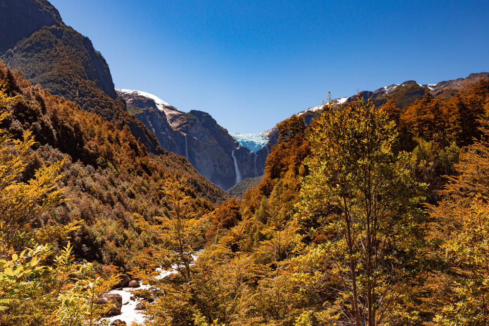
The park is renowned for the evergreen forests that blanket the glacier-capped mountain terrain. The park displays a region of the Puyuhuapi Volcanic Group as well as the Patagonian Andes. Collectively, the mountainous region features ice fields and snow-capped mountains.
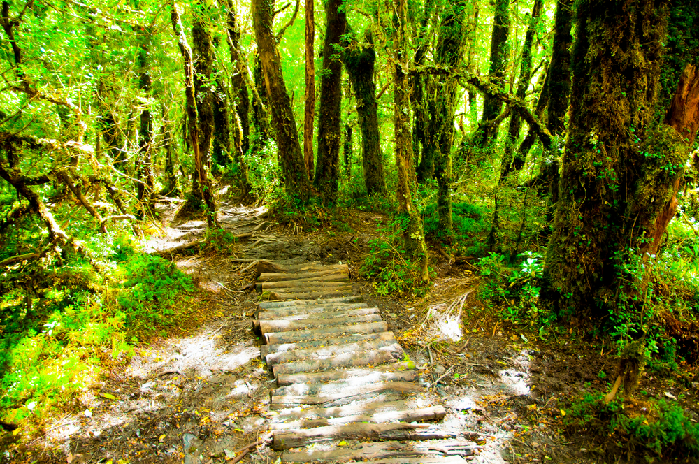
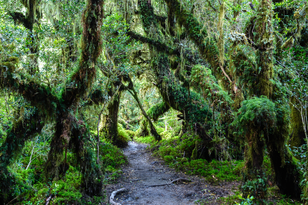
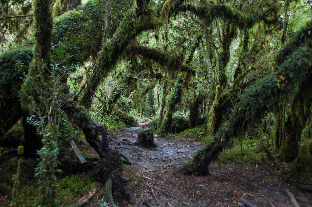
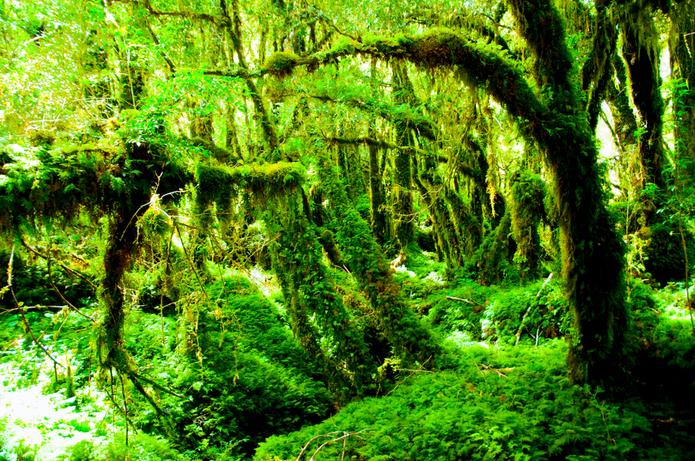
The mountains are surrounded by Valdivian temperate rain forests. The common trees of the forest include the coigue, tepu, tepa, and nalcas with higher elevations featuring the lenga and Magellan’s beech.
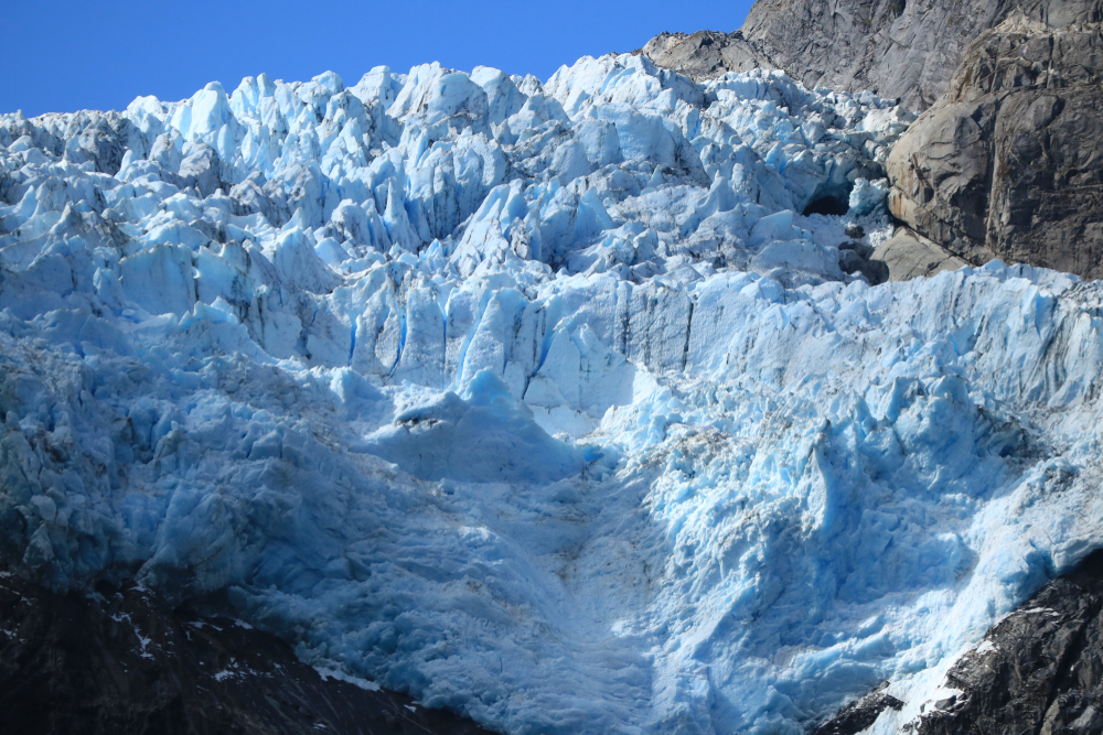
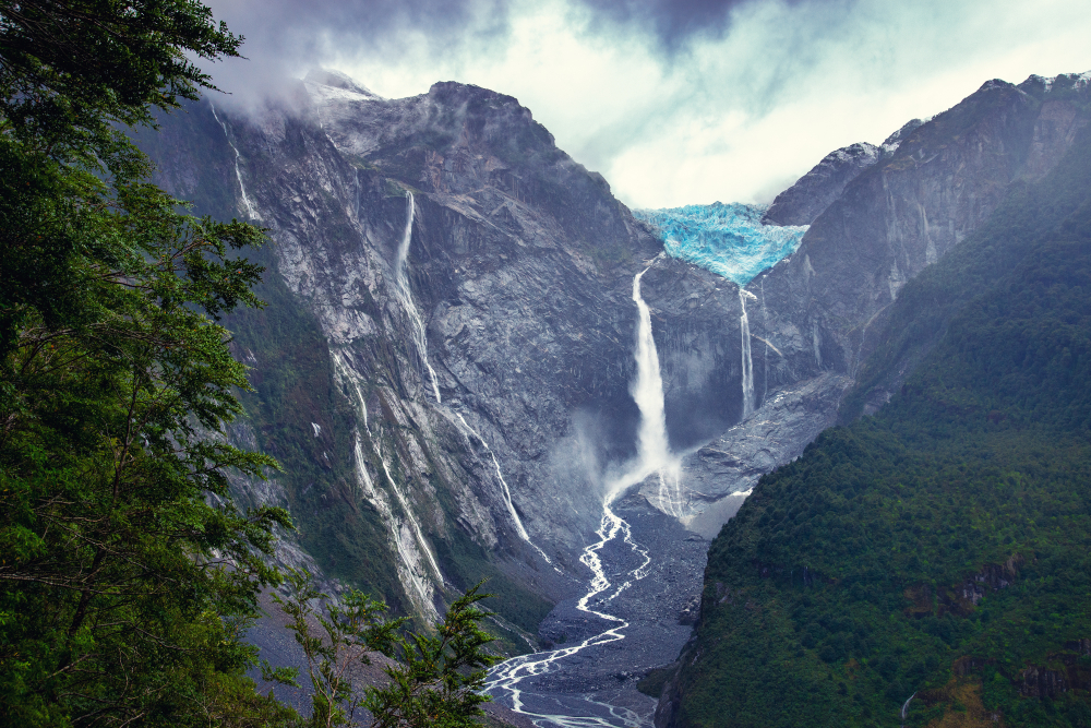
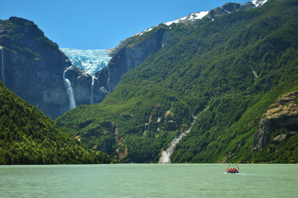
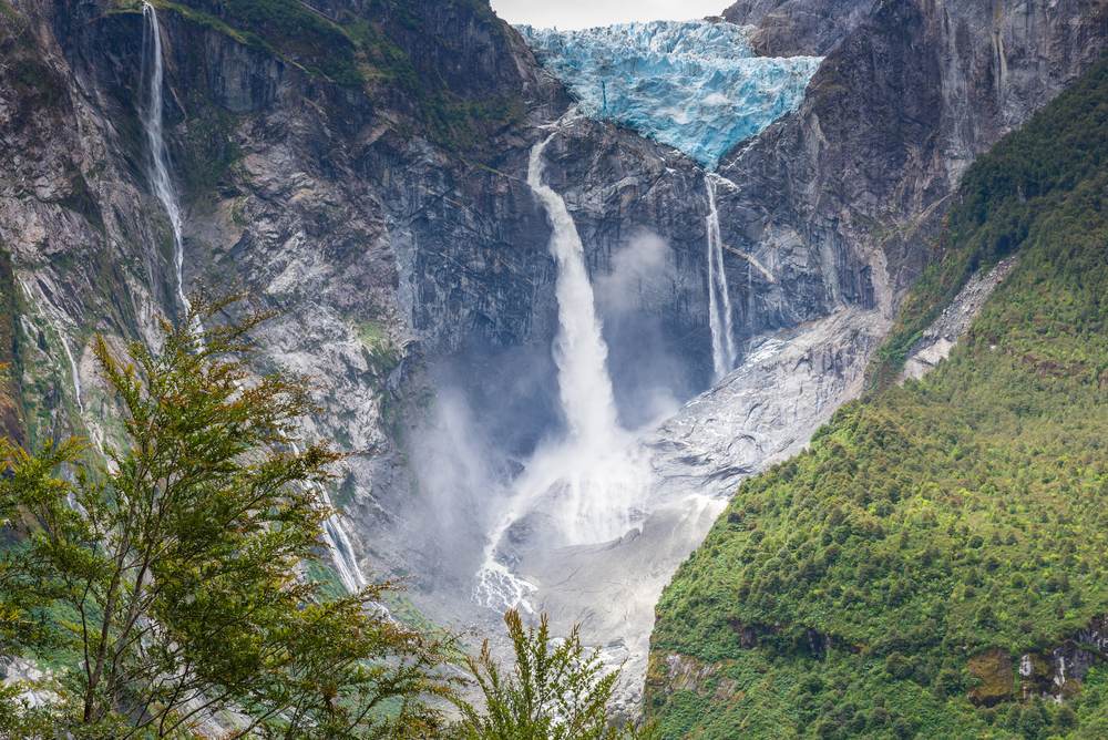
There are several glaciers with the longest reaching across 7 miles (12 km). Queulat Hanging Glacier provides the namesake of the park and is the largest glacier covering 31 square miles (80 sq km). The ice cap sits at 6,198 feet (1,889 m).
The snow-capped mountains melting runoff create waterfalls in various places in the park. Cascada de Ventisquero Colgante is one of the more remarkable large waterfalls that feed into the Tempanos River.
The park is not known for its wildlife, however, it is present. The ocelot-like kodkod is a coveted sighting. Other mammalian species include the pudu, coypu, and the river otter. Bird lovers will find a greater variety of species, including the Magellanic woodpecker, Chiloe wigeon, flying streamer, red-gartered coot, and the ringed kingfisher.
Photos


Things to See
Things To Do

Queulat National Park Trails
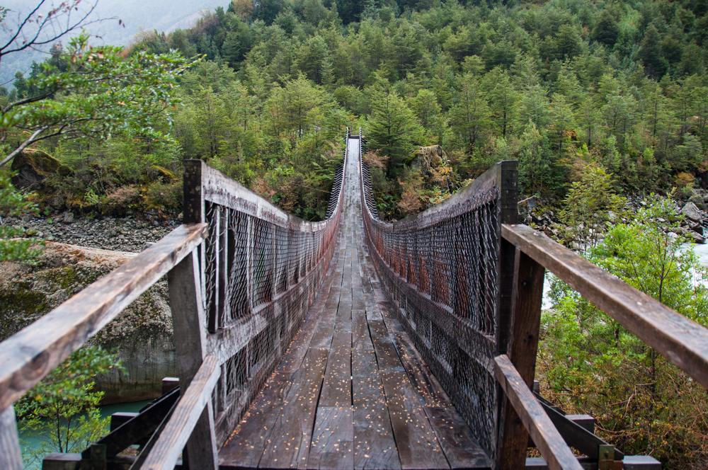
HIking and trekking are the primary activities of the park. There are three trails that traverse about the park with each featuring the opportunity to experience the temperate rainforest.
Park Protection
Queulat National Park was created to protect the pristine Valdivian temperate rain forests, the incredible ice fields, and the captivating landscapes for future generations. The park habitat also protects the environment for some of the endangered species like the Darwin’s frog.
Sources
- All Trails, Best Trails in Queulat National Park, https://www.alltrails.com/parks/chile/aysen/parque-nacional-queulat, retrieved January 2022.
- Go Chile, Queulat National Park, https://www.gochile.cl/en/queulat-national-park/, retrieved January 2022.
- LAC Geo, Queulat National Park Chile, https://lacgeo.com/queulat-national-park-chile, retrieved January 2022.
- Swoop Patagonia, Queulat National Park, https://www.swoop-patagonia.com/chile/aysen/queulat, retrieved January 2022.
- Wikipedia, Queulat National Park, https://en.wikipedia.org/wiki/Queulat_National_Park, retrieved January 2022.