About

Saxon Switzerland National Park is located in the eastern part of Germany near the Czech Republic border in the Free State of Saxony. The park covers an area of 36.1 square miles (93.5 sq km).

The Elebe Sandstone Mountains transcend the border and are protected Saxon Switzerland National Park on the Germany side and Bohemian Switzerland National Park on the Czech Republic side. The larger collective Saxon Switzerland expands across 274 square miles (710 sq km).

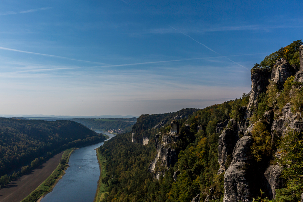
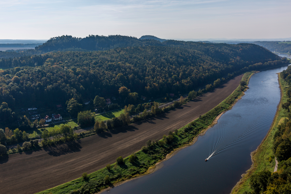
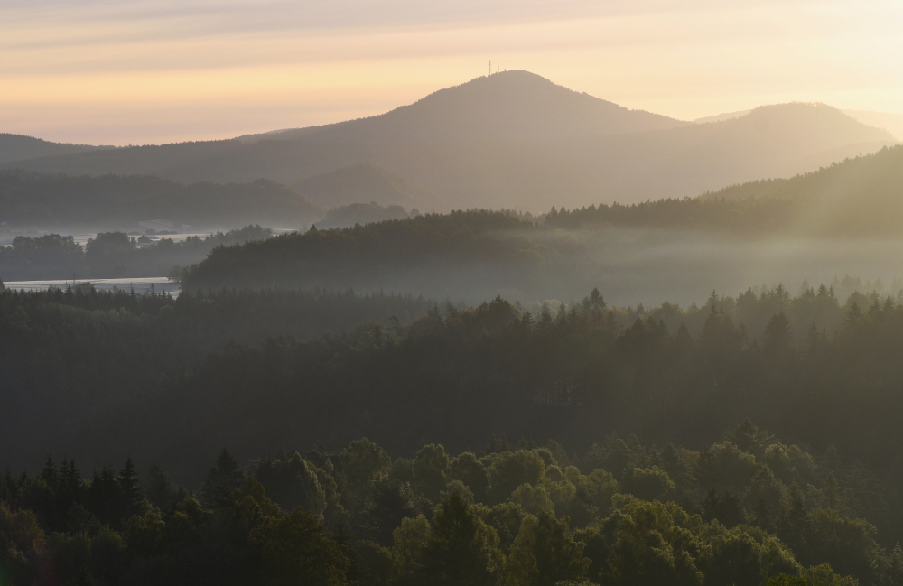
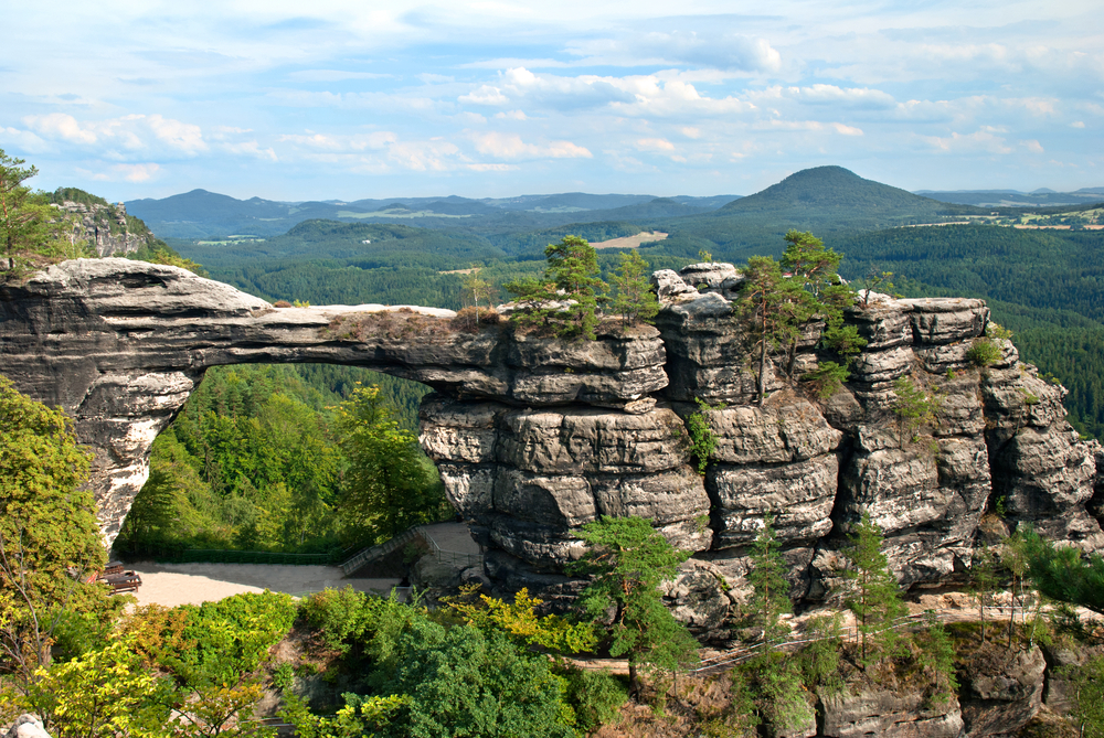
Although almost entirely covered in forest, the national park is comprised of fissured and rocky canyon landscapes. The tallest point reaches a height of only 1,814 feet ( 556 m), however, the neighboring Elbe river is at a lower elevation ranging from 360 to 390 feet (110 to 120 m).

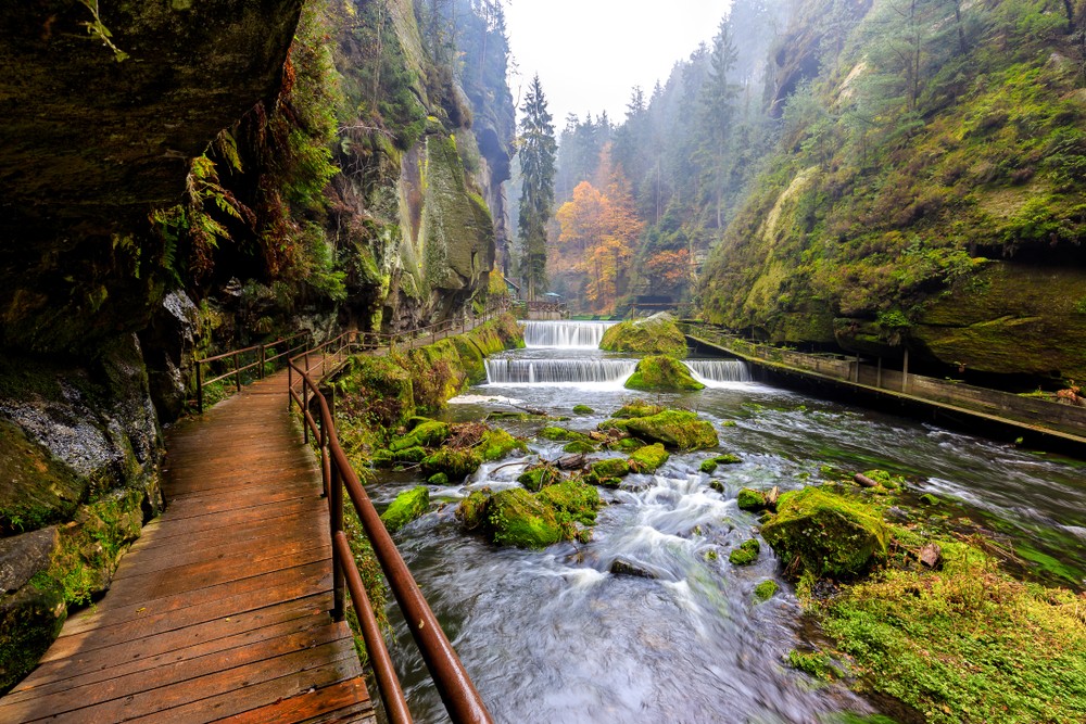
The national park features an array of habitats that include steep ravines, flowered and grassy meadows, moors, plateau mountaintops, and an abundance of forests.

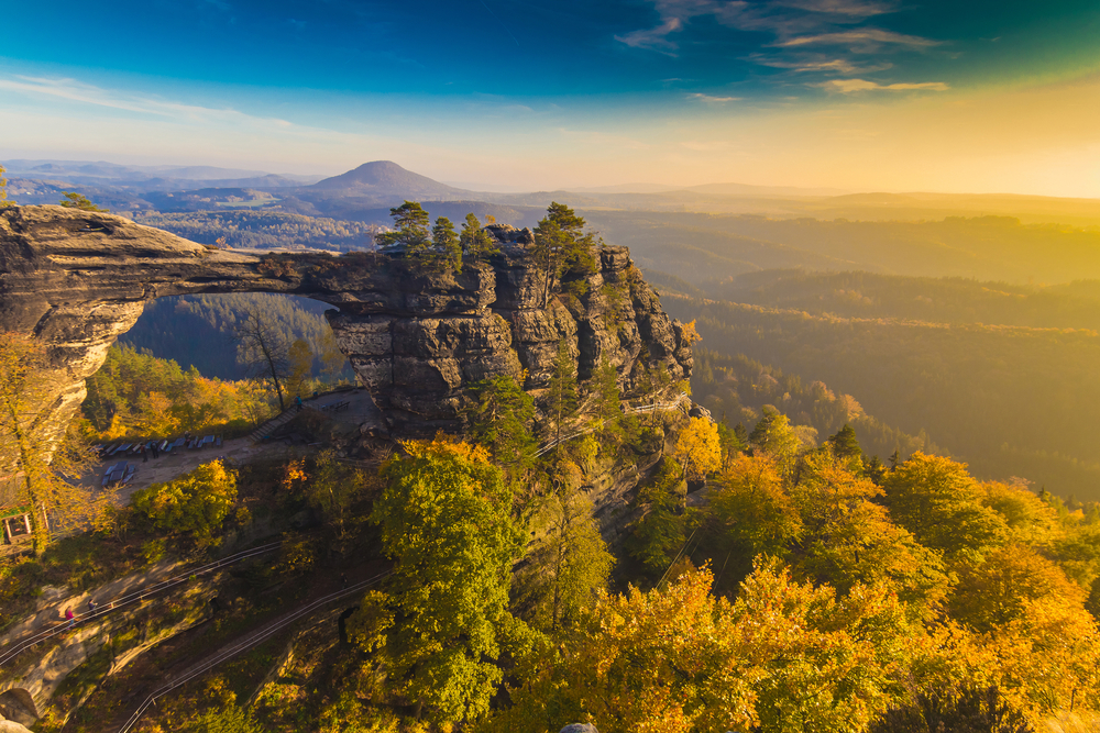
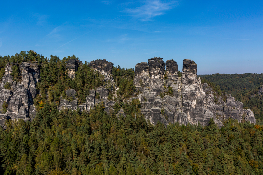
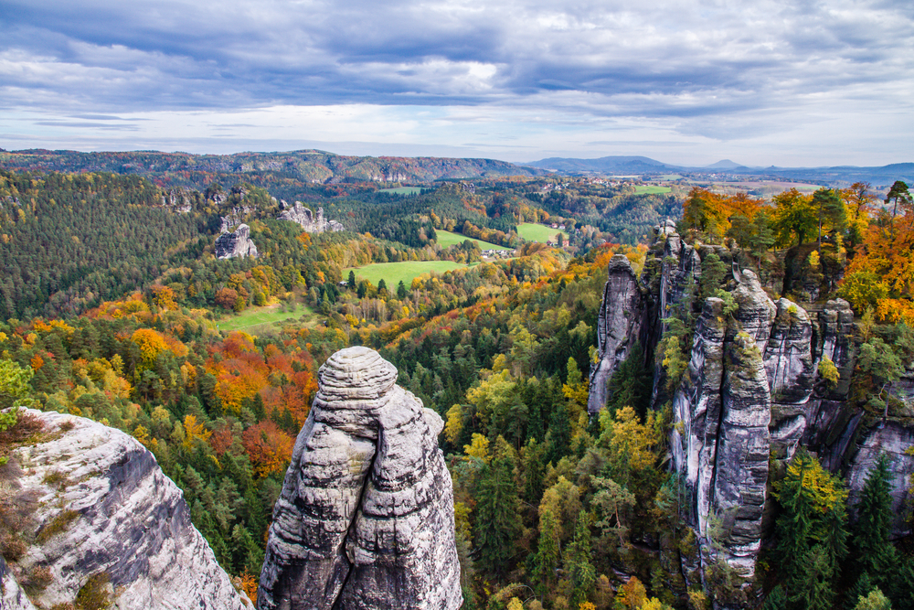
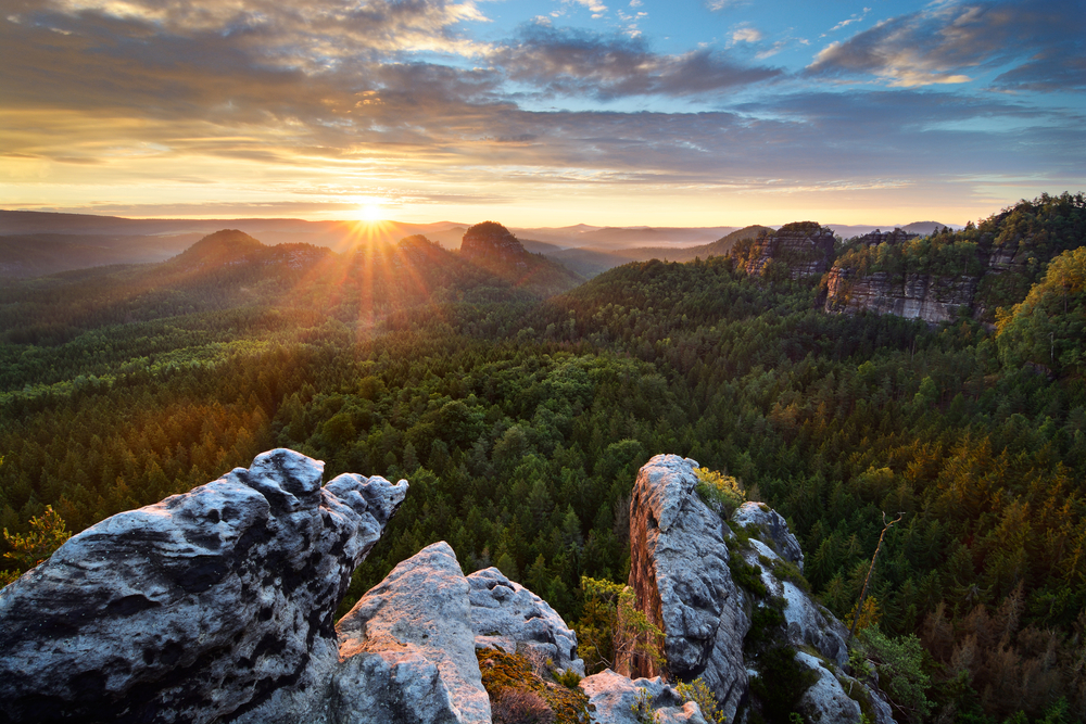
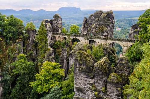
One thing that is unique to the national park as compared to much of Europe is areas of the forest that is void of human interaction. The city in stone is part of the highlights of the park. These sandstone cliffs, mesas, gorges, and spires create a “city” of stone.

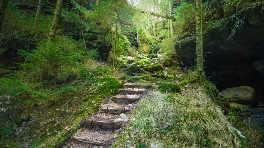
There are currently 250 miles (400 km) of hiking paths and another 31 miles (49.9 km of paths for bikes. The climbing options are almost endless.

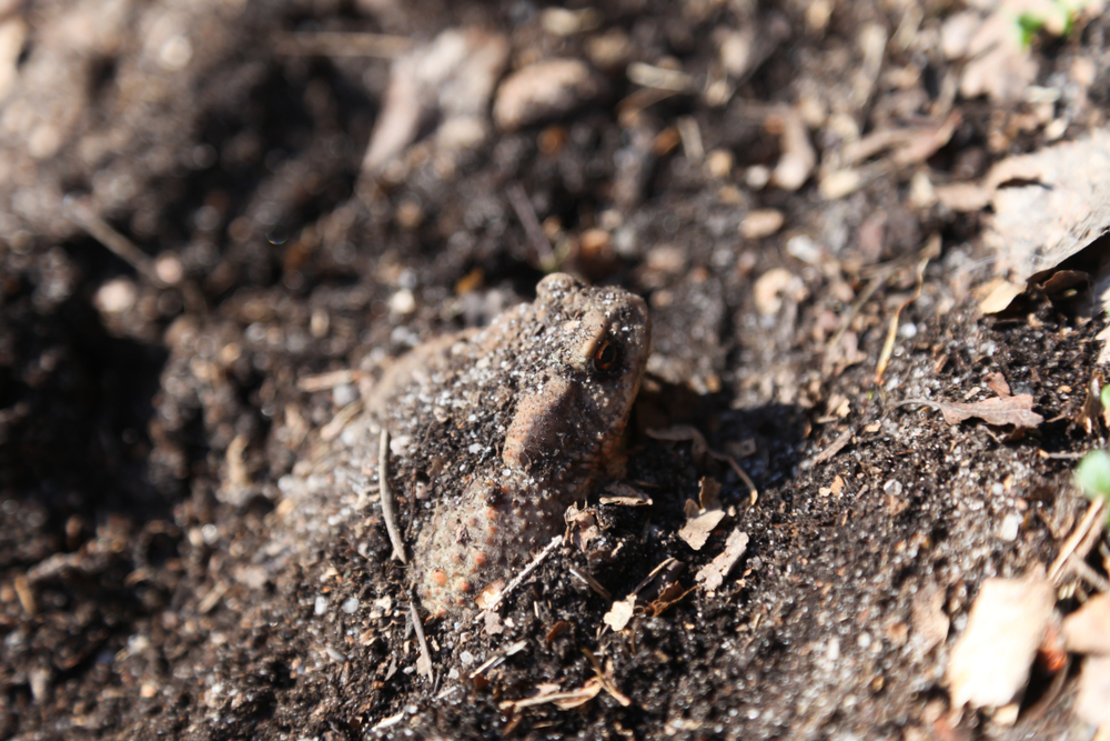
Wildlife is limited; however, it is present. Otter, lynx, deer, are some of the more popular species. The peregrine falcon and horned owls make for great animal sightings as well.

Things to See

Saxon Switzerland National Park is renowned for the Bastei bridge which is a beautiful scene itself. It also affords visitors with one of the best lookout points overlooking the Saxon Switzerland area. For the climber, the park is extraordinary because there are countless climbing locations with over ten thousand different climbing routes.

Bastei bridge

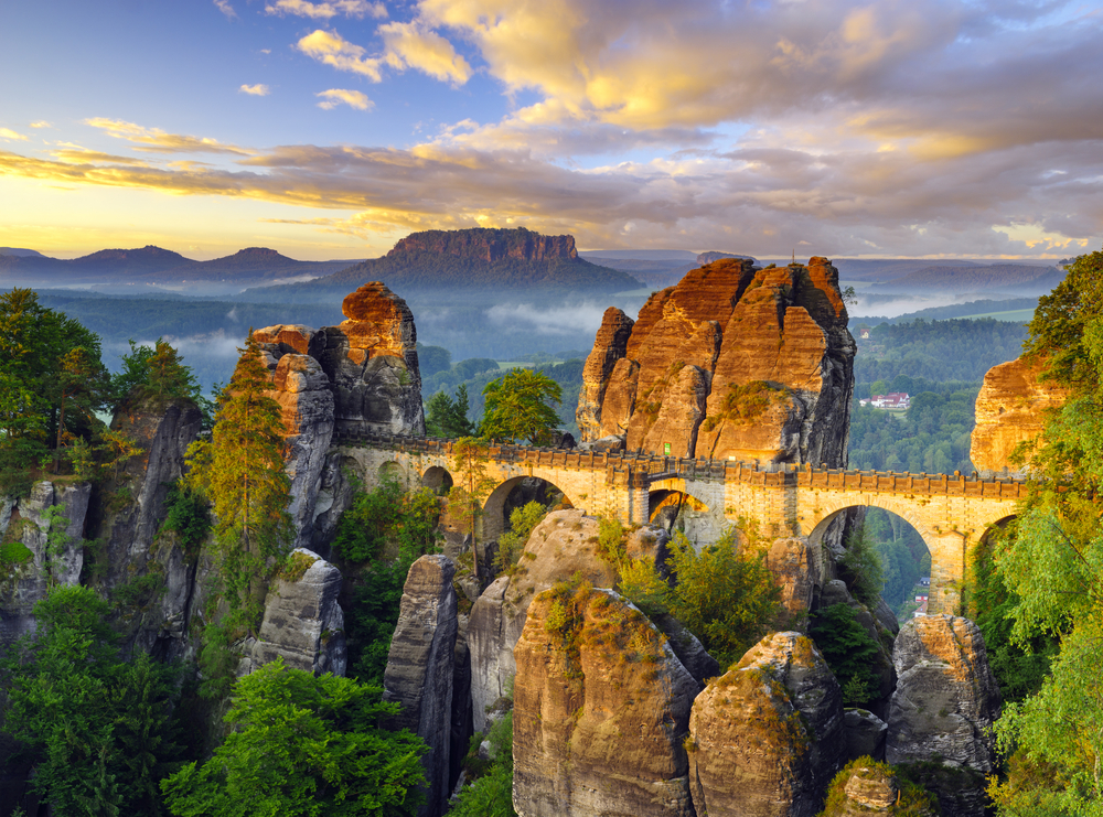
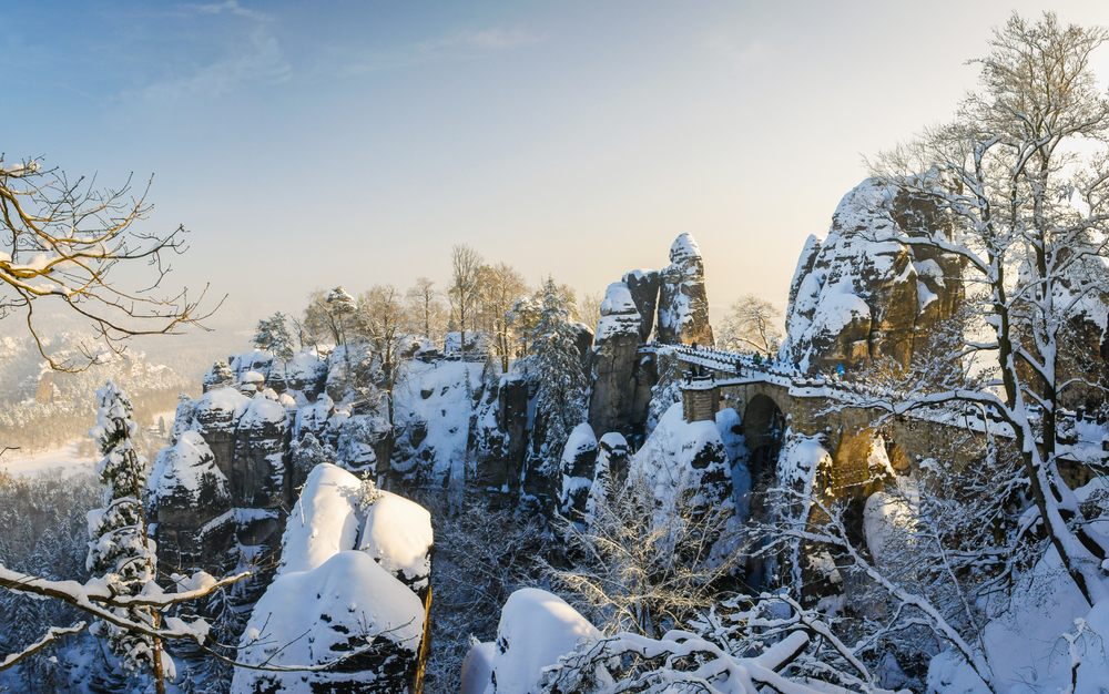
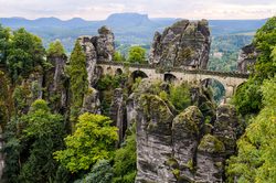
The rock bridge reaches a height of 636.4 feet (194 m) above the Elbe River below with the surrounding rock formations reaching heights of 1,000.6 feet (305 m). This city of stone is the pinnacle landmark of the national park.

The bridge is actually an integration between the architectural efforts of mankind combined with the naturally occurring rock formations.  This has been an iconic tourist destination in Germany for over 200 years.

There is a 487 step staircase that ascends out of the valley up into the rocks. Neurathen Castle may be reached by crossing the Bastei Bridge.

Neurathen Castle

This is the largest rock castle in Saxon Switzerland, Germany.  There are only remnants of the castle remaining which include a cistern, timber rebates, rooms carved into the rocks, and similar ruins.  Although in ruins, the Neurathen Castle remnants add to the intrigue of the Bastei Bridge.

Saxon Switzerland National Park Trails

The monoliths are the pinnacle attraction but the discovery and exploration don’t stop there.  Hiking in the national park will take you through forests, around lakes, over and along rivers, past waterfalls, along canyons, and into caves.  This park really provides you with an opportunity to engage nature with over 620 miles (998 km) of trails.

placeholder

Schrammsteine Trail

This trail engages a metal staircase to get you up above the cliff with a stunning panoramic view of the lush forests, rolling hills, and monoliths. The trail travels 4.5 miles (7.2 km) and takes about two hours.  It is rated as moderate.

placeholder

Bastei Bridge & Swedish Holes Loop

This is a 3.9-mile (6.2 km) loop that is quite possibly the most popular trail in the park because it takes visitors to the iconic Bastei Bridge with various views of it.  The Swedish Holes is a narrow canyon with a small waterfall that adds to the aesthetics of the area.

placeholder

Himmelsleiter Trail

This is a full-day hike covering 8.7 miles (14.0 km).  The trail meanders through slot canyons and along the edges of cliffs that give way to exquisite views of the valley.  You will come along a few waterfalls with a staircase to finish out at the summit.  Kuhstall is the park’s largest cave and this trail gives you access to discover and explore the cave.  Make sure you are in good physical condition, this trail is challenging and rated difficult.

placeholder

Malerweg Trail

If you really want an adventure, this is a multi-day (7-8 days) trek over 70 miles (112.7 km) of a moderate to difficult rated trail. This is a hiker’s adventure and provides those who embark on the endeavor a chance to really get an understanding of all the park has to offer.

Saxon Switzerland National Park

Bastei Bridge and Schwedenlöcher Trail

Rating: Moderate

Distance and Elevation Gain: 3 miles (4.8 km) round trip, with an elevation gain of 600 feet (183 meters)

Description: This iconic trail leads to the famous Bastei Bridge, offering spectacular views of the Elbe River and the surrounding sandstone formations.

The path then descends into the Schwedenlöcher, a series of steep, narrow gorges, before looping back.

Hikers are treated to breathtaking panoramas and unique geological features.

placeholder

Malerweg (Painter's Way) Section

Rating: Moderate

Distance and Elevation Gain: Varies, but one popular section is approximately 8 miles (12.9 km)

Description: Part of the larger Malerweg trail, this section meanders through some of the park’s most stunning landscapes, including dense forests and striking rock formations.

It’s a journey through the scenery that has inspired artists for centuries, offering diverse vistas and serene nature.

Saxon Switzerland National Park

Schrammsteine Viewpoint Trail

Rating: Challenging

Distance and Elevation Gain: 4 miles (6.4 km) round trip, with an elevation gain of 800 feet (244 meters)

Description: This strenuous hike takes adventurers through rugged terrain to the Schrammsteine Viewpoint, where they are rewarded with panoramic views of the park’s most dramatic rock formations.

The trail involves some scrambling and use of ladders, making it a thrilling experience for the adventurous hiker.

Saxon Switzerland National Park

Pravčická Brána Trail

Rating: Moderate

Distance and Elevation Gain: 3.5 miles (5.6 km) round trip, with an elevation gain of 500 feet (152 meters)

Description: Leading to the largest natural sandstone arch in Europe, this trail offers a relatively easy hike through beautiful woodlands and past scenic viewpoints.

The arch itself is a stunning natural monument, and the nearby Sokolí hnízdo (Falcon’s Nest) offers refreshments and historical exhibits.

placeholder

Kuhstall and Großer Winterberg Trail

Rating: Moderate

Distance and Elevation Gain: 6 miles (9.7 km) round trip, with an elevation gain of 700 feet (213 meters)

Description: This trail offers a diverse hiking experience through the park’s lush forests to the large natural cave known as Kuhstall.

The path then leads to the summit of Großer Winterberg, providing expansive views over Saxon Switzerland.

It’s a perfect trail for those looking to explore the natural beauty and panoramic vistas of the region.

Saxon Switzerland National Park

Bastei Bridge and Schwedenlöcher Trail

Rating: Moderate

Distance and Elevation Gain: 3 miles (4.8 km) round trip, with an elevation gain of 600 feet (183 meters)

Description: This iconic trail leads to the famous Bastei Bridge, offering spectacular views of the Elbe River and the surrounding sandstone formations.

The path then descends into the Schwedenlöcher, a series of steep, narrow gorges, before looping back.

Hikers are treated to breathtaking panoramas and unique geological features.

placeholder

Malerweg (Painter's Way) Section

Rating: Moderate

Distance and Elevation Gain: Varies, but one popular section is approximately 8 miles (12.9 km)

Description: Part of the larger Malerweg trail, this section meanders through some of the park’s most stunning landscapes, including dense forests and striking rock formations.

It’s a journey through the scenery that has inspired artists for centuries, offering diverse vistas and serene nature.

Saxon Switzerland National Park

Schrammsteine Viewpoint Trail

Rating: Challenging

Distance and Elevation Gain: 4 miles (6.4 km) round trip, with an elevation gain of 800 feet (244 meters)

Description: This strenuous hike takes adventurers through rugged terrain to the Schrammsteine Viewpoint, where they are rewarded with panoramic views of the park’s most dramatic rock formations.

The trail involves some scrambling and use of ladders, making it a thrilling experience for the adventurous hiker.

Saxon Switzerland National Park

Pravčická Brána Trail

Rating: Moderate

Distance and Elevation Gain: 3.5 miles (5.6 km) round trip, with an elevation gain of 500 feet (152 meters)

Description: Leading to the largest natural sandstone arch in Europe, this trail offers a relatively easy hike through beautiful woodlands and past scenic viewpoints.

The arch itself is a stunning natural monument, and the nearby Sokolí hnízdo (Falcon’s Nest) offers refreshments and historical exhibits.

placeholder

Kuhstall and Großer Winterberg Trail

Rating: Moderate

Distance and Elevation Gain: 6 miles (9.7 km) round trip, with an elevation gain of 700 feet (213 meters)

Description: This trail offers a diverse hiking experience through the park’s lush forests to the large natural cave known as Kuhstall.

The path then leads to the summit of Großer Winterberg, providing expansive views over Saxon Switzerland.

It’s a perfect trail for those looking to explore the natural beauty and panoramic vistas of the region.

Sources